


GPS Maps Live Navigation
3.918.00 Reviews
App Specs
- Version
- 1.4.2
- Updated On
- License
- Free
- Downloads
- 1,000,000+
- Developer
- TarrySoft
- Categories
- Maps & Navigation
- Platform
- Android
Screenshots
 Analysis by AppCompare
GPS Maps Live Navigation is the kind of app I would reach for when I need a straightforward route on my phone rather than a full travel-planning system. It sits in the Maps & Navigation category and focuses on the essentials: finding a route, following it with voice guidance, and checking traffic while I am on the move. After spending time with it, my impression is that its value depends heavily on how consistently my phone can stay connected and receive a usable location signal.
The app is free to install, aimed at Everyone, and comes from TarrySoft. It has passed the point of being an obscure experiment, with over a million installs, although its average rating sits at 3.9 from around two thousand ratings. That combination tells me to approach it as a practical option rather than assume it will replace every established navigation service. It can be useful, but the quality of the experience depends on the road, the network, the phone, and how much guidance I expect.
How GPS Maps Live Navigation behaves when connectivity matters
I find connectivity matters most before a trip begins, not just when traffic changes along the way. In this section, I’ll look at how I would prepare for a weak-signal stretch, what to do if guidance becomes uncertain, and why a sensible backup plan can matter more than another route adjustment.
Route planning is strongest when the phone can stay in touch
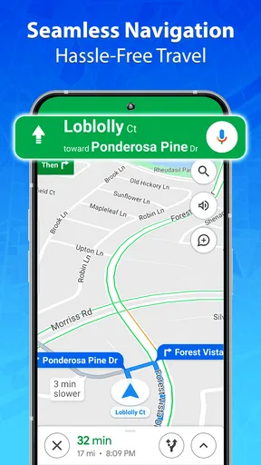
The central workflow is easy to understand. I enter a destination, let the app work out a route, and then follow the visual instructions and spoken directions. The live traffic element is especially dependent on current information reaching the device. When the connection is stable, that combination makes the app more useful than a basic map that only shows where I am.
I noticed that connectivity affects more than the traffic layer. A route request can feel less dependable when the phone is moving between weak signals, and updates during a journey are naturally more useful when the app can receive fresh information. This is not a criticism unique to this application; live navigation is built around changing road conditions. Still, it is important to understand the trade-off before relying on it for an unfamiliar trip.
The practical rule is simple: start the journey while the connection is reliable, not after leaving coverage. I would set the destination, wait for the route to appear, check the first major turns, and only then begin driving. That small habit reduces the chance of handling setup at a difficult moment, such as a busy junction or a crowded pickup area.
Live traffic is helpful, but it should not replace judgement
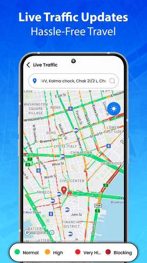
Traffic information can make a familiar route more informative because it adds context to the map. If a usually quick road is slowing down, I can at least consider whether the suggested route still makes sense. I would not treat every change as an instruction to take a complicated detour, though. A faster-looking alternative may involve unfamiliar turns, difficult lane changes, or a road that becomes slow again farther ahead.
Worth Reading Before You Choose

EA SPORTS FC Mobile 26 Is a Bigger Football Game, but It Takes Time

Flipboard Shows What News Apps Must Do Beyond the Feed

Switching to Android Auto Means Rethinking Your Driving Routine

Google Calendar Makes a Crowded Week Easier to Manage

Ludo King Makes the Most of the Minutes Between Plans

Baby Panda World Brings Quick Play to Modern Phones, but Its Game Library Feels Busy
My preferred approach is to use the traffic view as a decision aid rather than chase every minute of apparent savings. On a short local trip, the simplest route is often less stressful. On a longer drive, traffic awareness becomes more valuable, particularly before I commit to a major road. The app is at its best when it gives me information early enough to make a calm choice.
Voice guidance reduces screen dependence
Voice directions are one of the most important parts of the experience because they let me keep my attention on the road instead of repeatedly checking the display. I still glance at the map before complicated turns, but spoken prompts make ordinary stretches much easier to manage. This is also where phone placement matters: a device mounted too low, too far away, or in direct glare can make any navigation app harder to use.
I would test the voice output before starting a long drive. Music, podcasts, road noise, and a low phone volume can make otherwise clear instructions easy to miss. If I am driving with someone else, I also prefer to review the route while parked rather than rely on a last-second prompt. The app can guide me, but it cannot remove the need for safe attention and sensible preparation.
Using it during ordinary mobile situations
A realistic example is a trip across town to collect an order from a place I have never visited. I would search for the destination before pulling away, confirm that the selected result is the right one, and listen for the first instruction. During the journey, I would use the voice prompts for routine turns and check the screen only when the road layout becomes unclear.
At the destination, the final approach is where I would be most cautious. A navigation pin can bring me to the correct area without telling me which entrance, driveway, or parking access is easiest. I would slow down, look for signs, and avoid making an abrupt turn simply because the voice prompt has announced arrival. That workflow applies particularly well to shops, offices, and residential areas where the mapped destination may cover a larger property.
For walking, cycling, or public transport, I would be more selective. The app is presented as GPS navigation with route finding, traffic information, and voice directions, so my strongest confidence is in everyday road journeys. Someone who mainly needs detailed transit changes, trail planning, or specialist cycling information may find a dedicated service more suitable.
Small-screen use and the cost of multitasking
On a phone, navigation competes with incoming messages, calls, music controls, and battery demands. I would avoid switching between apps while moving, even if the route is familiar. The safer workflow is to set everything up before departure and let the navigation remain visible or audible.
For a passenger, the app can be more flexible. A passenger can inspect the route, compare a suggested alternative, or check whether the destination marker looks correct. For the driver, the important information should be reduced to the next instruction and the road ahead. This distinction sounds obvious, but it makes a noticeable difference when the screen is small or the route becomes busy.
What happens when the route does not go smoothly
No navigation tool is perfect at preventing wrong turns. I find the real test is what happens afterward. If I miss an exit or deliberately take another street, I want to give the app time to adjust instead of immediately tapping through menus. A calm recovery is usually better than trying to force the original route.
My recovery routine is to continue to a safe place, listen for the next instruction, and only then decide whether the new route is sensible. If the app is still trying to direct me back through a difficult junction, I would stop somewhere legal and restart the destination search. That is not a sign that the app has failed completely; it is a sensible way to reset a navigation session after the road situation has changed.
Connectivity can make recovery more complicated. A missed turn followed by weak service is a particularly uncomfortable combination because the phone may take longer to receive a revised route or current traffic context. I would not experiment with settings while driving. If guidance becomes unclear, I would use a safe stopping point, check the phone’s location, and confirm the destination again.
Location accuracy is part of the overall experience
People often blame the navigation app when the real problem is the phone’s location estimate. Tall buildings, underground sections, covered roads, and dense urban streets can make the position marker appear late or jump slightly. In those situations, I pay more attention to road signs and the shape of the junction than to a tiny moving icon.
A useful habit is to look ahead at the route before entering a complicated area. I want to know whether the next turn comes immediately after a roundabout, whether there are parallel roads, and whether the destination is on my side of the street. That preparation helps me interpret a delayed location update without making a sudden manoeuvre.
Managing data use without making the app frustrating
Because the experience includes live traffic and route updates, I would expect active navigation to use mobile data. I would not leave a route running unnecessarily after arriving, and I would avoid repeatedly recalculating the same journey just to compare tiny differences. Those habits keep the session more focused and reduce needless activity on a limited mobile plan.
Before a long journey, I would also check the phone’s battery level and charging arrangement. Navigation, a bright display, location services, and mobile connectivity can place a noticeable demand on a phone over time. A car charger or a charged power bank is more useful than discovering halfway through a trip that the device is struggling.
There is another data-conscious choice that is easy to overlook: decide the destination precisely before starting. Searching for several nearby places while already moving creates extra distraction as well as extra network activity. I prefer to confirm the street, town, and destination name while parked. This is particularly important when several businesses or buildings share similar names.
Free access, optional spending, and what to consider
The app is free, which makes it easy to try without committing money upfront. It also contains in-app purchases ranging from less than a dollar to amounts reaching ninety-nine dollars per item. I would check the purchase screen carefully before confirming anything, especially if I am only looking for basic navigation.
That pricing range changes how I evaluate the app. Free access is attractive for occasional trips, but I would not assume that every extra option is essential to reach a destination. My advice is to use the core experience first, understand what is already available, and decide whether any paid addition solves a problem I genuinely have. Someone who wants a completely predictable navigation cost should pay close attention to those optional purchases.
How it compares with familiar alternatives
The usual alternatives in this category tend to fall into two groups. Large, established map platforms often offer a wider ecosystem around places, reviews, saved locations, and other travel information. Dedicated navigation tools may put more emphasis on driving controls, route preferences, or specialised road information. GPS Maps Live Navigation appeals more to me when I want a focused route-and-guidance experience without turning the task into a broader map research session.
That focus can also be a limitation. If I am choosing a restaurant based on extensive place information, planning several stops, or combining driving with public transport, a larger map platform may be more convenient. If I am preparing for a trip where connectivity is uncertain, I would choose a service whose offline behaviour and downloaded map coverage are clearly suited to that need rather than assume live navigation will be enough.
The app makes the most sense for someone who wants a free starting point, uses a compatible phone, and normally travels in areas with dependable mobile service. It is less convincing for a professional driver who needs specialised fleet functions, for a traveller who expects detailed offline preparation, or for anyone who dislikes checking optional purchases before using an app.
Device compatibility and the current release
The current version is 1.4.2, and it supports phones running Android 6.0 or newer. That broad minimum requirement makes the app accessible to people who are not using the latest handset, although the actual smoothness will still depend on the phone’s hardware, screen, battery condition, and network connection.
I would give the app permission to settle into a normal route before judging it on an older device. A phone that is overloaded with background tasks may make map movement or voice playback feel less responsive. Closing unnecessary apps, keeping the display readable, and mounting the phone securely are practical improvements that cost nothing.
Who should use it, and who should keep looking
I would recommend trying it if your navigation needs are mainly everyday driving: commuting, visiting an unfamiliar address, finding a quicker route around traffic, or getting spoken instructions without paying an upfront fee. The simple focus is approachable, and the combination of route finding, traffic awareness, and voice prompts covers the basics many people need.
I would steer a friend elsewhere if their trips regularly pass through areas with unreliable service, if they need extensive offline planning, or if navigation is only one part of a much larger travel workflow. I would also suggest comparing alternatives before paying for optional items, particularly when a competing app already provides the specific feature they need as part of its normal experience.
My connectivity verdict
After using GPS Maps Live Navigation, I see it as a practical live-navigation companion rather than a universal travel toolkit. Its strongest moments come when I prepare the destination in advance, keep the phone connected, let voice guidance handle routine turns, and treat traffic information as useful context instead of an absolute command.
The main lesson is that the app’s convenience is tied to the conditions around it. A stable connection, a charged phone, a clear destination, and a safe recovery habit make the experience considerably better. Without those basics, the same live features can become a source of uncertainty at exactly the wrong time.
For a free app from TarrySoft with an Everyone rating and a sizeable user base, it is worth testing on the routes you actually drive. I would begin with familiar journeys, observe how quickly it reacts when traffic or turns change, and only then decide whether it deserves a permanent place on my phone. It is a sensible choice for connected, everyday trips, but not the app I would trust blindly when coverage, battery, or route complexity is the real challenge.
Pros
- Live traffic updates help avoid congestion and delays.
- Turn-by-turn voice guidance keeps driving hands-free.
- Offline map support can reduce mobile data usage.
- Quickly finds nearby gas stations
- restaurants
- and services.
- Route options make it easy to compare faster or shorter journeys.
Cons
- Traffic information may be inaccurate in less-covered areas.
- Some advanced navigation features may require a subscription.
- The app can drain battery during long trips with GPS enabled.
- Map downloads may use considerable storage space.
- Heavy reliance on GPS and data can affect performance indoors.
FAQs for GPS Maps Live Navigation
What is GPS Maps Live Navigation, and what can I use it for?
GPS Maps Live Navigation is a mobile navigation app designed to help you plan routes, follow turn-by-turn directions, and find locations while traveling. It can be useful for driving, walking, or exploring unfamiliar areas, depending on the features available in your version. The app generally combines GPS positioning with map data to display your current location and guide you toward a selected destination.
Does GPS Maps Live Navigation require an internet connection?
An internet connection may be needed for downloading map information, searching for places, receiving traffic updates, and calculating certain routes. GPS positioning itself can often work without mobile data, but offline performance depends on whether the app supports downloaded maps and whether you saved the required areas beforehand. Users should prepare maps in advance if they expect to travel through areas with weak or unavailable signal.
Is GPS Maps Live Navigation accurate and reliable while driving?
The app can provide helpful route guidance, but its accuracy depends on GPS signal strength, map coverage, device quality, and the freshness of the map data. Tall buildings, tunnels, mountains, bad weather, or indoor use may affect positioning. Drivers should always follow road signs and local traffic regulations, keep the phone mounted safely, and avoid interacting with the screen while the vehicle is moving.
Does GPS Maps Live Navigation provide live traffic information and route changes?
Some versions or features of GPS Maps Live Navigation may offer live traffic conditions, alternative routes, road alerts, or estimated arrival times. These functions usually require an active internet connection and may vary by country, map provider, subscription level, or app version. Before relying on real-time updates for an important journey, check which traffic and rerouting tools are actually available on your device.
Is GPS Maps Live Navigation free to download and use?
GPS Maps Live Navigation may be available as a free download, but certain functions can include advertisements, optional purchases, subscriptions, or limitations. Premium features may involve offline maps, advanced navigation tools, traffic information, voice guidance, or an ad-free experience. Review the app-store listing and its in-app purchase details before downloading so you understand the available features and any recurring charges.


